Algorithm description OD-Matrices
OD matrix from points as table (n:n) below as .csv instead. Parameter names also changed:
“From-Point Layer”/“To-Point Layer” are now Origin point layer/Destination point layer, and the advanced “Entry Cost calculation method” parameter has been removed (cost is now always ellipsoidal, using the network layer's own CRS ellipsoid). See Changes from QNEAT3.
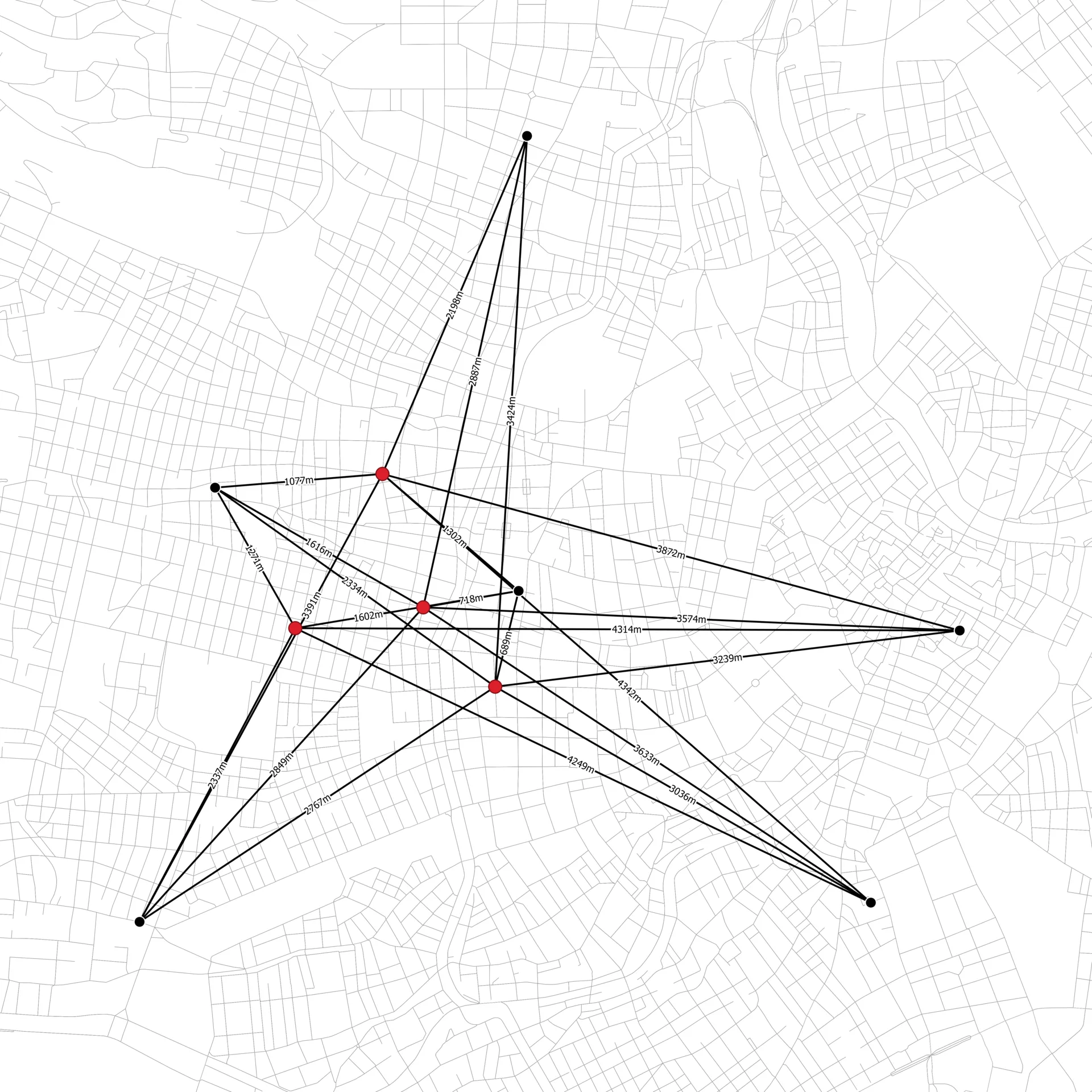 Data Source: Stadt Wien – data.wien.gv.at
OD matrix from layers as lines (m:n)
Computes the network route-based cost of origin-destination relations between the points of two layers (layer m and layer n). Cost components are split into entry-cost, network-cost, exit-cost and total cost (sum of all other components). The relation is displayed as a straight line (or the actual routed path, depending on the matrix output type) between the origin and destination point, with the costs as attributes.
| # | Mandatory Parameters | Type | Info |
|---|---|---|---|
| 1 | Network layer | Vector Layer | Geometry type must be LineString |
| 2 | Origin point layer | Vector Layer | Geometry type must be Point |
| 3 | Origin point ID field | Field | preferably an Integer field |
| 4 | Destination point layer | Vector Layer | Geometry type must be Point |
| 5 | Destination point ID field | Field | preferably an Integer field |
| 6 | Optimization criterion | Shortest | Fastest | - |
| 7 | Output OD matrix | Output Vector Layer | - |
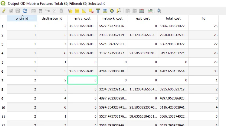
OD matrix from layers as table (m:n)
Computes the network route-based cost of origin-destination relations between the points of two layers (layer m and layer n).
Cost components are split into entry-cost, network-cost, exit-cost and total cost. The relation is displayed as rows in an attribute table —
use QGIS's “Save to file” output option to export the result directly as .csv.
| # | Mandatory Parameters | Type | Info |
|---|---|---|---|
| 1 | Network layer | Vector Layer | Geometry type must be LineString |
| 2 | Origin point layer | Vector Layer | Geometry type must be Point |
| 3 | Origin point ID field | Field | preferably an Integer field |
| 4 | Destination point layer | Vector Layer | Geometry type must be Point |
| 5 | Destination point ID field | Field | preferably an Integer field |
| 6 | Optimization criterion | Shortest | Fastest | - |
| 7 | Output OD matrix | Output Table | no geometry — can be saved directly as .csv |
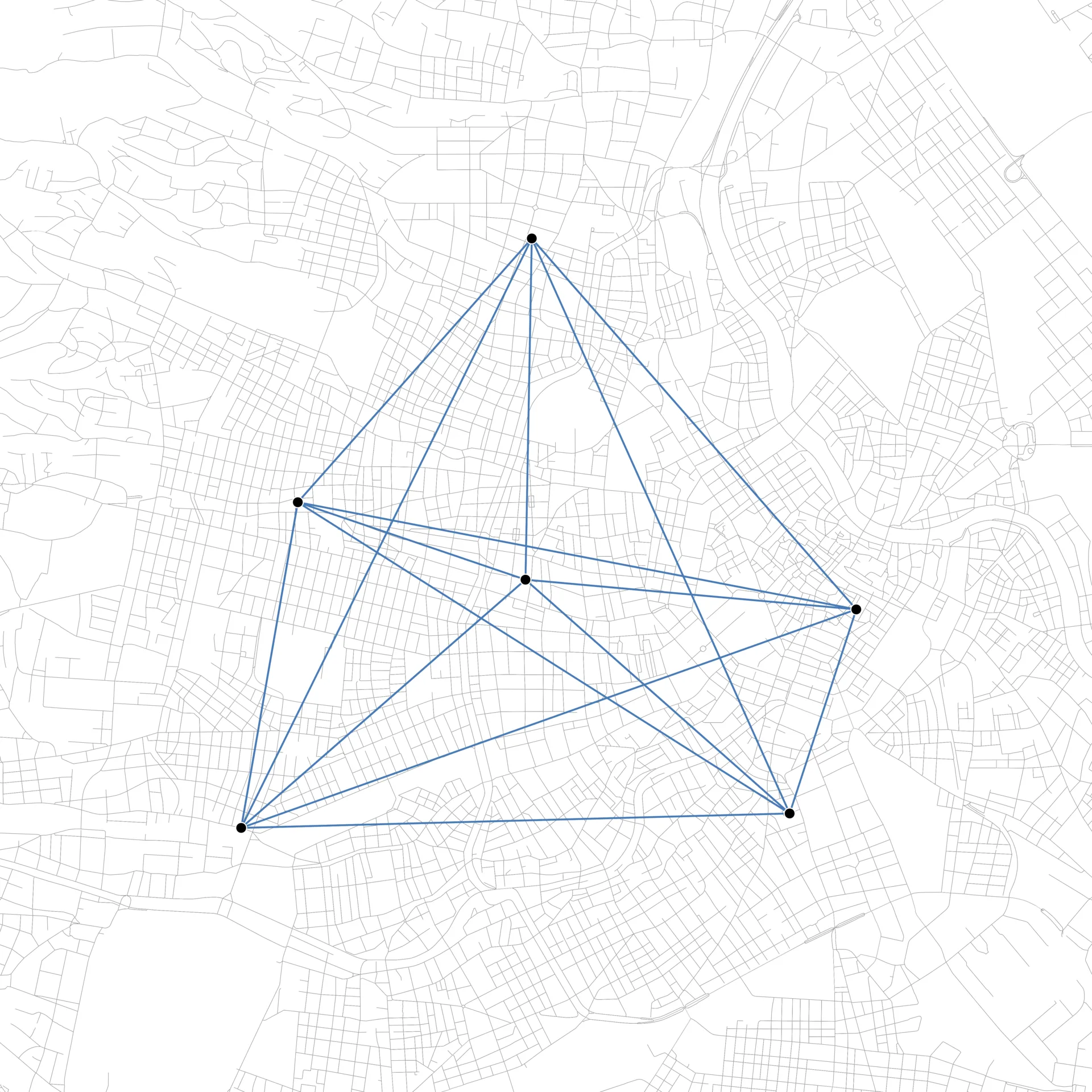 Data Source: Stadt Wien – data.wien.gv.at
OD matrix from points as lines (n:n)
Computes the network route-based cost of origin-destination relations between all points inside a single layer (n:n). Cost components are split into entry-cost, network-cost, exit-cost and total cost. The relation is displayed as lines (or routed paths, depending on the matrix output type) between those points.
| # | Mandatory Parameters | Type | Info |
|---|---|---|---|
| 1 | Network layer | Vector Layer | Geometry type must be LineString |
| 2 | Point layer | Vector Layer | Geometry type must be Point |
| 3 | Point ID field | Field | preferably an Integer field |
| 4 | Optimization criterion | Shortest | Fastest | - |
| 5 | Output OD matrix | Output Vector Layer | - |
OD matrix from points as table (n:n)
Computes the network route-based cost of origin-destination relations between all points inside a single layer (n:n).
Cost components are split into entry-cost, network-cost, exit-cost and total cost. The relation is displayed as rows in an attribute table —
use QGIS's “Save to file” output option to export the result directly as .csv (this replaces the removed “OD-Matrix from Points as CSV” algorithm).
| # | Mandatory Parameters | Type | Info |
|---|---|---|---|
| 1 | Network layer | Vector Layer | Geometry type must be LineString |
| 2 | Point layer | Vector Layer | Geometry type must be Point |
| 3 | Point ID field | Field | preferably an Integer field |
| 4 | Optimization criterion | Shortest | Fastest | - |
| 5 | Output OD matrix | Output Table | no geometry — can be saved directly as .csv |
Optional parameters (all OD-Matrix algorithms)
| # | Optional Parameters | Type | Info |
|---|---|---|---|
| 1 | Matrix output type | Line | Route | only on the two “as lines” algorithms; straight line vs. the actual routed path |
| 2 | Direction field | Field containing direction values | - |
| 3 | Value for forward direction | user input | input must be referenced to Direction field |
| 4 | Value for backward direction | user input | input must be referenced to Direction field |
| 5 | Value for both directions | user input | input must be referenced to Direction field |
| 6 | Default direction | Forward direction | Backward direction | Both directions | used when no direction field is set, or a feature's direction value doesn't match any of the above |
| 7 | Speed field | Field containing speed values | must be numerical |
| 8 | Default speed (km/h) | user input | (!) sets network entry- and exit-speed |
| 9 | Topology tolerance | user input | Tolerate gaps in network (crs units) |